Still no suitable weather for my first solo cross country but I am revising hard for my met exam. Richard asked if we had done precautionary search and landings. No I replied, so off to the briefing room we went.
The idea here is unlike a PFL and basically gliding down because of engine failure, you plan you landing and make it under power. Its something you would do if you needed to get down, if you thought you would not make it back to the airfield because of bad weather or bad light.
The take off was normal and we headed west further then I had been in the training area before. As we crossed the river Trent we radioed Humberside Radar and informed them what we were intending and if we could stay on there frequency and not hand over to Doncaster.
At this point I started a slow descent to 1000′ feet and started looking for a suitable field. Suddenly I spotted some movement over to my left.
“Microlight 10 O’Clock low, moving right to left.”
I announced to Richard my Instructor. A few moments later and Richard said he had them, then almost immediately Richard announced.
“Second Microlight 2 O’Clock low, following same track.”
I halted my descent and made a small turn to the left and then to right having a good look round. No one else in sight so I continued on my route.
We finally spotted a field to make the attempt. Not perfect as it was not into wind but the best we could find with all the water-logged fields around.
Having chosen my field the next step was to make three circuits, inspecting the surface and general vicinity. I slowed down and selected the first stage of flaps and descended to 500′ feet. I then made a slow circuit as if to land but on final leg keeping the field to my left to have a good look.
I then made my second inspection run. This time from 300′ feet. First I added a second stage of flap. This was more difficult. At this height I was getting turbulence and maintaining a consistent height and speed was difficult.
After passing the field on final I now descended to 100′ feet. I was now concentrating harder then I had in a long time. On each turn I increased power a little to ensure I did not lose any more speed. Stalling at this height would have be in the ground in no time at all.
With this final inspection circuit made it was now time for the mock landing. This would be landing from low height at minimum speed. The idea is you touch down at the moment of stalling. I made my approach from 100′ feet and added the final and third stage of flap. Down into the field I flew then at about 50′ feet at very slow speed Richard announced he was happy and to climb away. I applied full power, leveled off and let the speed increase. I then removed a stage of flap and climbed away at 80 knots. Wow that was intense!
I climbed up to 1000′ feet and headed back to the field via the Elsham VRP.
The rejoin was fine but my landing was poor. I misjudged the round-out. Might need to book a session in the circuit to get my hand back in.
We taxied back and shutdown. Once back at the club house Richard gave us a debrief. Now for some good weather and that solo cross country.

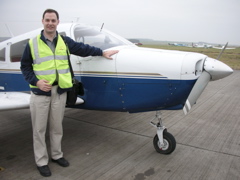
 The night before I had done some extensive planning and a full set of mock wind calculations. I had also got a new map. I normally use a 1:250000, but the the nav exam calls for a 1/2 mill map, so I thought this trip would be a good practice for this. This morning we arrived at Humberside airport and I got to work. First getting all the latest weather reports. I could not believe it. No wind! None. So much for my careful planning and practice. No wind vectors to worry about. Richard my instructor arrived and we talked about what we planned to do and he checked my plans and map. With everything looking good to go, I got Caroline a headset and we headed out to check out the plane.
 The last plane Caroline had been on had been a little Embraer ERJ-145, which had taken us on holiday to Slovenia. My little Piper PA-28 is quite a bit smaller but after checking out the outside I got her comfy strapped in the back and finished of my checks when Richard arrived. We soon had the plane started and lined up on runway 21 ready for take-off. On reaching 500 feet I made a right turn and headed for the local visual reference point, the old airfield at Elsham, but all thats left now is a collection of buildings. On the way there we passed the other major marker for the airfield, the local quarry.
 Once clear of the airfield I turned onto my first co-ordinates 311 (T) Track, which I had calculated at 311 (T) Heading (no wind) which gave a heading of 313 (M). There is a small island in the middle of the Humber and if I was on course I would fly directly overhead. I was surprised to find that I was actually on course! Wow, but really there was no excuse with there being no wind.
 I had calculated that it would take 19 minutes to get to York and it was with relief I found myself over York about 20 minutes later. I banked gently over, no sudden or sharp turns to upset my passenger.
 This second stage of the journey was the most difficult. Few landmarks, so difficult to check my navigation but eventually I spotted Driffield but a bit close to my right but still not to bad, and from there I could spot my next destination Bridlington.
 The third stage was the easiest, my turning point was just below Bridlington. and Caroline got this lovely shot of Flamborough Head as I banked over to my next heading 191 (M) for the final 18 minutes home.
 Hull finally appeared and with that the Humber Bridge. We came over Hull, crossed the river and was soon cleared to land. We were soon down once again and Caroline had experienced her first flight we me at the controls.